Mikhail Orekhov
Every lover of traveling long distances by car should learn how to use a navigator: leave a route, download updates. This is difficult for those who have recently purchased a device and do not yet know how to use all its capabilities, or for those who are planning to visit a new country whose map is not available in the navigator. In the latter case, uploading maps to the navigator becomes necessary.
The easiest way to load maps into is by contacting the service center. Professionals will easily select the necessary software and install the necessary data in a minimum time.
The price of the service (the most complex option) does not exceed 1 thousand rubles. And in this case, the car enthusiast can be calm about the reliability of the downloaded information.
Self-installation of cards
Taking on this process yourself can save you money. To do this, you need to visit the official server of the navigation program whose brand of device you are using. Next, log in to the site and go directly to the instructions for downloading maps:
- Select the “Personal Account” section on the website.
- In the “My Devices” section, find the “Updates” subsection and select it.
- Next, you need to determine which software corresponds to the navigator model and download it into the memory of your personal computer.
- Unpack the update archive. This will require special program to unpack archives.
- Connect the device to a personal computer via a USB cable
- By saving the downloaded add-on to the “Maps” section on your device, complete the work.
To continue using the navigation device, just reboot. In accordance with software reboot and partition addresses may not correspond to each other.

When loading new data into the navigator, you should make sure that it has enough free memory. Otherwise you should delete it unnecessary files, having previously saved them on your computer.
Modern updated models of navigators are equipped with Wi-Fi function, allow you to easily synchronize necessary information immediately. To do this you need:
- On the website, select the section responsible for the software and find the required update.
- Allow the navigator to use updated settings.
- Reboot the device.
Further available updates will download automatically. If this does not happen, you need to perform the steps manually again.
When downloading updates, the system will require you to enter license key, which is indicated on the packaging or instructions for the navigator. If the packaging is lost and the license number cannot be recovered, there is a method described below that will tell you how to download updates.
Downloading non-original software
The Internet is full of free-to-use sites that offer new maps for any navigation system. Home distinctive feature such resources are non-original, which is added to the site ordinary users. Maps may have some differences from the "real" versions, but still be reliable. The process of downloading data is no different from the method described above. The updated data will be saved separately in the designated folder.
Read how to install GPS in your car.
If the gadget model is not equipped with the function of adding files, you will not be able to make updates on these sites.
To summarize, it should be noted that downloading the necessary maps into the navigator is not a complex process that requires you to prepare. It is enough to connect to the Internet, register on a site that has software. And if suddenly there are problems in the implementation of the plan, you can always rely on the help of a professional.
Almost all Android and iOS smartphones have built-in GPS sensors to track the device and geolocation anywhere in the world. Especially for this, dozens of applications are being developed that at any moment will display your location on the map, notify you of traffic jams, show you the nearest restaurants, cafes, schools and other infrastructure different types and level.
Today, there are several main programs that are used for navigation: Google Maps, 2GIS, Navitel, Yandex Maps.
Main advantages of Navitel
- Free trial period of 30 days
- Supports almost all gestures on a touchscreen device
- Works with all versions of Android, iOS
- Support for offline mode (see )
- Loading and deleting maps of any city, country, region
- Ability to transfer maps and applications to SD card
This is just a small list of the capabilities of the Navitel program. And if earlier it was installed only in specialized devices - GPS navigators, now it is present in almost every smartphone, and is also available for download from services Google Play and Apple Store. As practice shows, many users cannot independently install the program on the device and make all the necessary settings. In this regard, the question arises - how to install Navitel on Android?
We will describe several installation methods:
- Installation via apk
- Installation via .exe
- Installation from Google Play service
How to install Navitel using apk file
You can download the file both from the official Navital website, and from any other portal that provides such an opportunity. However, it is worth considering that some sites distribute malware along with applications. Therefore, if you are not sure about the reliability of a particular portal, then it is better to go to the official website and download the distribution kit of the latest available version from there.
- Go to the official Navitel website (www.navitel.ru)
- At the top, click the "Download" tab
- Now on the left side click “Distributions”
- The page will show full list files for Android version. It will also be possible to go to the official Google service Play or Apple Store directly from the site using the necessary links. Attention! This page first presents versions for Android smartphones, Windows Phone, Symbian, and below are files for car navigators.
- Once the file is downloaded, transfer it to your phone. It is best to copy directly to a flash card, because all maps of cities will also be downloaded there (each from 10 mb to 1.8 GB).
- On your Android smartphone, run file manager and open the apk app. The installation wizard will appear, which will present a complete list of trusted actions from Navitel. Click "Install" and wait for the application to be installed on your phone. Once the installation is complete, you can download the maps and use free version within 30 days.
Don't forget to register the program and purchase a full license!
Installing Navitel via exe file
Installation of the program can also be done through a standard Windows installer. To do this you will need to connect your mobile phone Android to computer via USB port.
- Go to the official Navitel website.
- Click the “Download” tab - “Distributions”.
- Select the exe version from the list.
- Once the file is downloaded to your computer, run it. Follow the system prompts. Within a few minutes, the GPS navigator will be installed on your smartphone.
Within 30 days the application will work in a free mode, but in the future you will need to register the program and purchase a full license.
How to install a navigator via Google Play
If you have Internet access from your phone and a Google Play account, then you can download and install the Navitel navigator directly from there, without wasting extra time connecting your phone to a computer, searching for files on the official website. So, how to install Navitel on Android?
You need to do the following:
- Open your phone's menu and select Google Play.
- Log in with your account and enter the name of the program in the search bar.
- Select the Navitel application and click the "Install" button.
- A notification will appear on the screen about the capabilities of the application, as well as about trusted actions that will be available to Navitel after installation.
- Once the download is complete, go to the program and register it by purchasing a full license. Remember that you can use the application for free for 30 days!
How to install Navitel maps on Android
 By default, the application is installed “naked”, that is, it does not contain any maps. The user himself chooses which ones he needs and downloads them separately from the application or from the official website.
- To download maps from the official website, go to www.navitel.ru
- Select the “Download” tab at the top of the site, go to “Maps”.
- A complete list of countries for which maps are available will be presented here. Select the required cities and download the files to your computer. Then, after the download is complete, connect the device via a USB cable and transfer the files to the sdcart/Navitel/Content/Maps folder.
If you have access to the Internet from a smartphone (preferably WiFi connection), then you can download all files directly from the application.
- Launch the program on your phone.
- Go to the “My Navitel” tab - “Download maps”.
- Select the desired list of maps and wait until the download completes.
Navigators provide convenience to many motorists, simplifying the task of finding the optimal route and thereby saving time. However, maps may be out of date or not accurate enough. In this case, there is a need to replace them with more modern ones.
Where to get cards?
The most simple solution in this case, you will need to purchase license cards or install them from the official website. But you can also go your own way by downloading from third-party resources.
Before uploading maps to your navigator, you need to weigh all sides of the issue. After all, after installing a card with a missing license, problems may arise with providing a guarantee from the service center.
Using any of the selected methods, you should know that the entire installation comes down to easy copying file. And if the navigator does not automatically detect the files, you need to find the path to them yourself.
Additional tools to solve the problem
Garmin navigator users can update or install maps using the MapSource program included on the disk. But to work with Linux system the use of the QLandkarteGT program is provided, but the result may vary.
Let's look at the sequence of how to upload maps to a Garmin navigator.
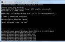
First, you will need to download the MapSource program, unpack and run the MSMAIN.msi file. Once the download is complete, you should run Setup.exe to complete the installation.
Having work program, let's move on to the question of how to download maps. In the navigator, for starters? you need to select maps directly of the desired area and unpack the archive. Among the unpacked files we find install.but and run it, however, before starting the process you need to turn off Garmin Maps Source.
Direct work with Garmin Maps Source means connecting the device to a computer with via USB. Using the program, you need to specify the path to the required map, mark the file with the “Select Map” tool and click on upload to the navigator.
It should be noted that previous version The map of the installed region will be automatically deleted.
Updating in Difficult Situations

Most Prestigio navigators even when purchased have very old version navigation system. Before uploading maps to the navigator, it is recommended to first update the system by installing the software from the website and using it to update the device.
When updating, the program will offer a service such as uploading maps to the navigator. Prestigio works mostly with the Navitel program, which has a very strict policy regarding third-party cards.
When loading maps into Prestigio, there are a few details you should know. If your navigator does not have a flash drive, the installation location should be the Maps folder in the device memory. If you have a flash drive, the path will change to the memory card in the Maps section. If there are no such partitions, you should restart the device, and the navigator itself will create the necessary directories.
If the device does not automatically detect the card, you need to upload it to any folder. After downloading, using the “atlas” navigator function, specify the path to the folder. The device will independently create an atlas from all the files found in the folder. It is worth noting that the navigator indexes all maps, so it is better to divide the folders by region.
The solution might be interesting
The most original way to upload maps to a navigator is to create them yourself. In a situation where there is no information about the region of interest, the question arises of how to upload maps to the navigator. Explay or a device from another brand supports the jpeg image format, which means you can scan a paper card.

First, we need a high-quality scan of the selected map with a north orientation. Next, you need to select key points on the map, preferably several. Find out the width and longitude of each selected point and enter the data into the created text file. The file must be saved in HTM format.
After creating a folder on your device, copy Text Document with coordinates and a scanned map of the area. By indicating the location of the map to the navigator, make sure the functionality and quality of the resulting image.
Good to know

- To download maps to the navigator via USB, the navigator must be turned off, and only after disconnecting the cable can it be turned on.
- Older versions of maps almost always resolve themselves when newer ones are loaded.
- Always create backups before installing unverified cards.
- When buying a navigator, it is not always possible to get in addition to it the desired card.
- By installing cards from a third-party source, there is a risk of voiding the warranty.
- You can find a suitable map on the official websites.
Mikhail Orekhov
Every lover of traveling long distances by car should learn how to use a navigator: leave a route, download updates. This is difficult for those who have recently purchased a device and do not yet know how to use all its capabilities, or for those who are planning to visit a new country whose map is not available in the navigator. In the latter case, uploading maps to the navigator becomes necessary.
The easiest way to load maps into your navigator is by contacting the service center. Professionals will easily select the necessary software and install the necessary data in a minimum time.
The price of the service (the most complex option) does not exceed 1 thousand rubles. And in this case, the car enthusiast can be calm about the reliability of the downloaded information.
Self-installation of cards
Taking on this process yourself can save you money. To do this, you need to visit the official server of the navigation program whose brand of device you are using. Next, log in to the site and go directly to the instructions for downloading maps:
- Select the “Personal Account” section on the website.
- In the “My Devices” section, find the “Updates” subsection and select it.
- Next, you need to determine which software corresponds to the navigator model and download it into the memory of your personal computer.
- Unpack the update archive. To do this, you will need a special program for unpacking archives.
- Connect the device to a personal computer via a USB cable
- By saving the downloaded add-on to the “Maps” section on your device, complete the work.
To continue using the navigation device, just reboot. Depending on the software, the reboot and partition addresses may not match each other.
When loading new data into the navigator, you should make sure that it has enough free memory. Otherwise, you should delete unnecessary files by first saving them on your computer.
Modern updated models of navigators are equipped with Wi-Fi function, allowing you to easily synchronize the necessary information immediately. To do this you need:
- On the website, select the section responsible for the software and find the required update.
- Allow the navigator to use updated settings.
- Reboot the device.
In the future, available updates will be downloaded automatically. If this does not happen, you need to perform the steps manually again.
When downloading updates, the system will require you to enter a license key, which is indicated on the packaging or instructions for the navigator. If the packaging is lost and the license number cannot be recovered, there is a method described below that will tell you how to download updates.
Downloading non-original software
The Internet is full of free-to-use sites that offer new maps for any navigation system. The main distinguishing feature of such resources is non-original software, which is added to the site by ordinary users. Maps may have some differences from the "real" versions, but still be reliable. The process of downloading data is no different from the method described above. The updated data will be saved separately in the designated folder.
Read how to install GPS in your car.
If the gadget model is not equipped with the function of adding files, you will not be able to make updates on these sites.
To summarize, it should be noted that downloading the necessary maps into the navigator is not a complex process that requires you to prepare. It is enough to connect to the Internet, register on a site that has software. And if suddenly there are problems in the implementation of the plan, you can always rely on the help of a professional.
This method works for all versions of Garmin navigators, except PC versions of the system; in the latter case, failures are possible. First you need to unlock your navigator. To do this, you need to find out the device ID. Simply turn on your Garmin, select Tools, then go to Settings, and then select System. The top field will indicate the ID and multi-digit number. Copy it to a computer (for example, to a notepad).
- Then download KeyGen 1.5 unlocker for Garmin)
- After downloading the application, open it and enter your ID (numbers only) in the top field. Depending on the operating system enter your operating system type - Garmin Mobile XT or Garmin, then click Generate.
- Copy the code to the field Your software unlock code
- In the folder window settings, configure the display of file extensions, this will be useful in the future.
- Then open notepad and paste the resulting code into the program window. Save the resulting file as sw.unl. If the file is created as sw.unl.txt just delete (F2) the excess.
The resulting file must be uploaded to the Garmin folder. (folder X:/Garmin/)
Disable and re-enable Garmin. Now we are ready to install the cards.
Installing maps on Garmin
The navigator itself is capable of working with four navigation maps. Each card should be renamed according to the principle:
- Gmapbmap.img - usually the base map.
- Gmapsupp.img - your map,
- Gmapsup2.img - your second map
- Gmapprom.img - your third map
In this review we will install one card. To get started, connect your Garmin in data transfer mode. Maps can be freely distributed in the form of several options:
- As an EXE file
- In the form of an IMG file with a FID number.
- In the form of an IMG file, already cured with a universal code. The card should be renamed according to the principle described above.
- Installing EXE Cards
Typically, maps are automatically installed in the C:\Program Files\Garmin folder. By default it may contain REG file s, which should also be manually transferred to this folder on the device and run the REG file. Running the registry file is necessary to recognize the map in the system using the MapSource program. In any case - either it is a self-extracting archive, or a group of files - you need to transfer it and open the REG file on the device.
- Installation of IMG cards with FID number.
For cards with the IMG extension, you should find out its FID number. Usually it is indicated in the name of the card on file hosting services. You should create an unlock for this card. Rename the map according to the principle described above Gmapsupp.img must be present, then if you need a second one - Gmapsup2.img, a third - Gmapprom.img. Save all FID numbers of the cards you want to work with
- Launch KeyGen (in the downloaded archive).
- Select item
- Enter your FID card in the top field.
- Press the bottom Generate button.
- We save the resulting code to a file in Notepad, calling the file for maps Gmapsupp.img and GMAPSUPP.UNL (if it turns out to be GMAPSUPP.UNL.TXT, rename and remove .TXT). If you do it for the second card, then accordingly there should be a pair Gmapsup2.img Gmapsup2.UNL, for the third card - a pair Gmapprom.img Gmapprom.UNL
Import the resulting maps into the Garmin directory on the device
Configuring and resizing maps on your Garmin navigator.
Then we launch Garmin, open the MapSource applications until we see a list of maps we have installed. We launch the desired map, then use the zoom function (ZOOM) until we see the map in the entire screen of the device. Then click on Map Tool, select those parts of the map that we need (usually this is done to save space). Selected areas turn pink. Then click the Send to Device item with the navigator connected to the PC. In this case, the device replaces GMAPSUPP.UNL, so for the changed card you will need to generate a new UNL or rename your main card.